
Due to the rapid development of information technology and location-based services, traditional maps can no longer meet the needs of fine management in all walks of life. Therefore, in all industries, the demand for refined maps is becoming more and more urgent, and the requirements on such maps are also becoming more and more rigorous. Large-scale maps are favored by more and more industries because of their fine features such as higher map precision and more abundant map data and information, among others, the vector map data with a scale of 1:2000 is more widely demanded and used in the current construction of digital city.
Introduction to Map Data of Cennavi
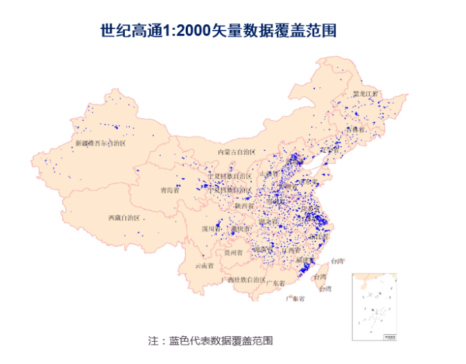
Cennavi, the big data company of NavInfo Group, has a large amount of map data and location information data. By the end of 2019, the high-quality map data products have covered 8 million kilometers of roads in the country, including more than 30 million POIs and more than 10 million entries of house numbers and address data. The map data can be updated daily and the map accuracy can reach centimeter level. Among them, the Cennavi’s vector map data with a scale of 1:2000 covers 71,000 square kilometers, including 271 cities and 1,296 districts and counties through the country. Data attributes include building, background (green space and water system), road and annotation (hamlet annotation and points of interest) and other elements, which have been applied in many fields such as public security, operators and insurance.